HOW TO USE EURATLAS HISTORICAL POLITIES
GENERAL
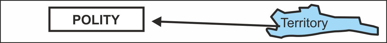
There are many informative and historical atlases that depict the ancients and medieval lands, kingdoms, counties, cities, duchies and more. However, since our knowledge of ancient boundaries and territories is scarce, these maps often cover a rather fuzzy period of time. As such, they are named «Area X in the 13 C.» or «Area X about the 13 C.» for instance. This is so viewers may see two polities that didn't exist simultaneously but successively at an interval of 5 or 10 years on the same map. Moreover, many maps follow the dominant sources so closely that it is virtually impossible to ascertain the difference between effective control over a specific land, and the claimed authority over it. It should also be noted, that the very definitions of a state, of sovereignty, of an administrative division, or of a «dependent» or «vassal» country for instance, were not the same throughout the course of history. As such, it is challenging to navigate the tangle of multiple allegiances that characterized the Medieval polities.
The Euratlas Historical Polities project - currently in progress - aims to offer a valid description of the existing polities at a defined point in time. In fact, this typically at the start of each centennial year. This is done through an accurate formal model with database, graphs, maps, and references. This is the map of 1200 Common Era (C.E.) You will find a detailed explanation in the following article: A FORMAL MODEL FOR HISTORICAL ATLASES AND HISTORICAL KNOWLEDGE
KEY FEATURES AND RULES OF THE EURATLAS HISTORICAL POLITIES MODEL
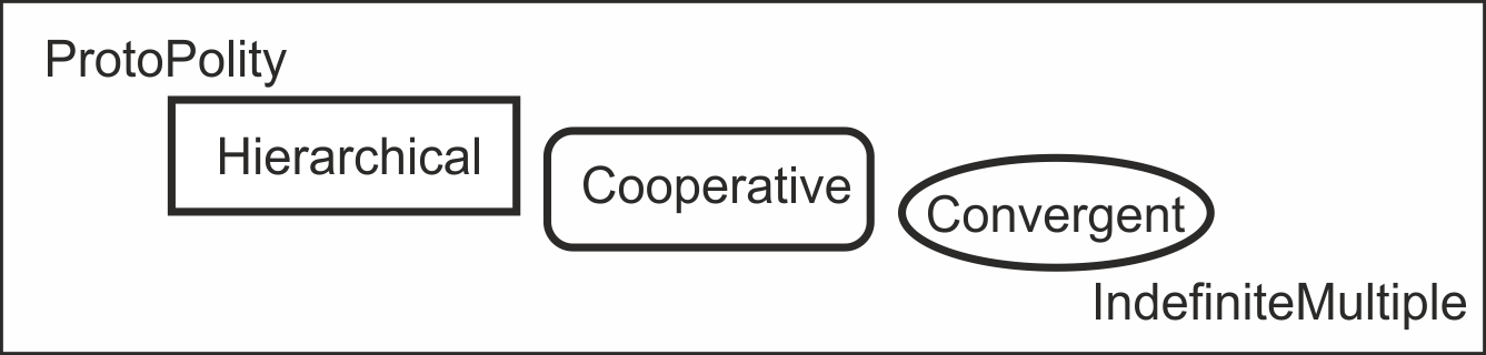
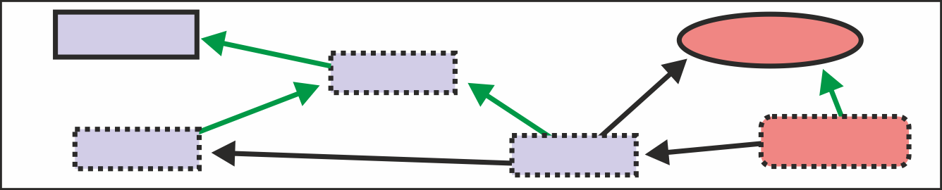
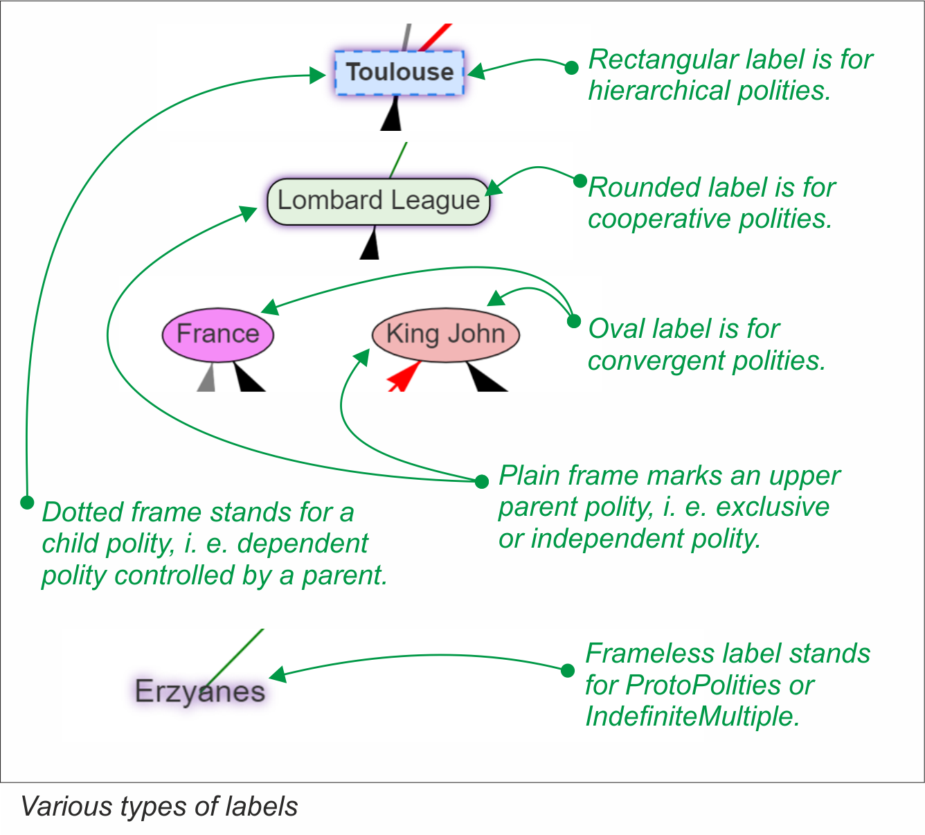
- ProtoPolity: ill-defined entity,
- Hierachical: holding its members in subordination,
- Cooperative: group gathering several equal entities,
- Convergent: same ruler for many whatever entities,
- IndefiniteMultiple: region subject to several poorly known polities
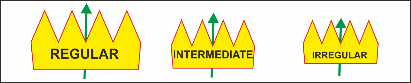
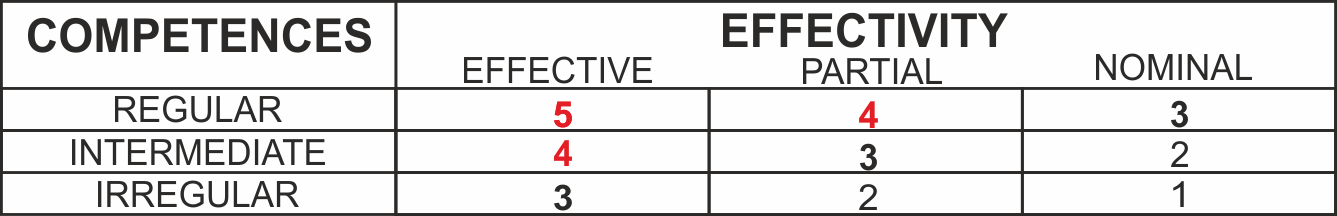
- Regular: full power exercised by the parent polity,
- Intermediate: some autonomy is left to the child entity,
- Irregular: parent entity has a weak power over the child entity.
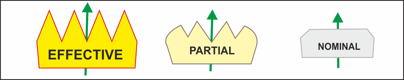
- Effective the relation matches the demands of the parent entity,
- Partial the relation matches main demands of the parent entity,
- Nominal stands for a purely theoretical relation.
GRAPHICAL USER INTERFACE
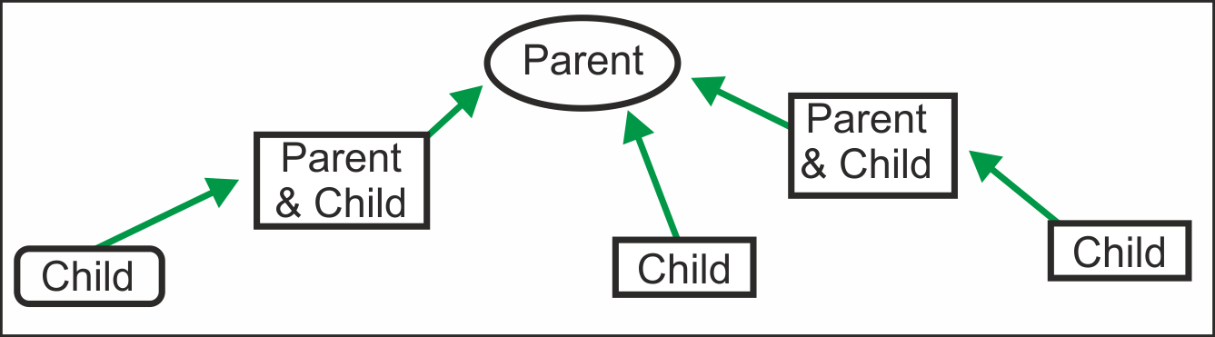
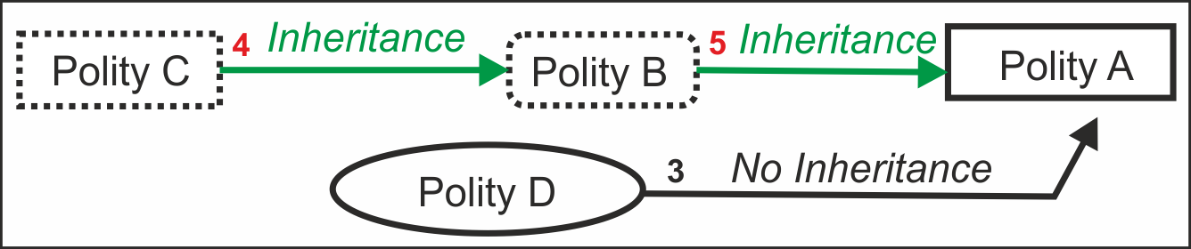
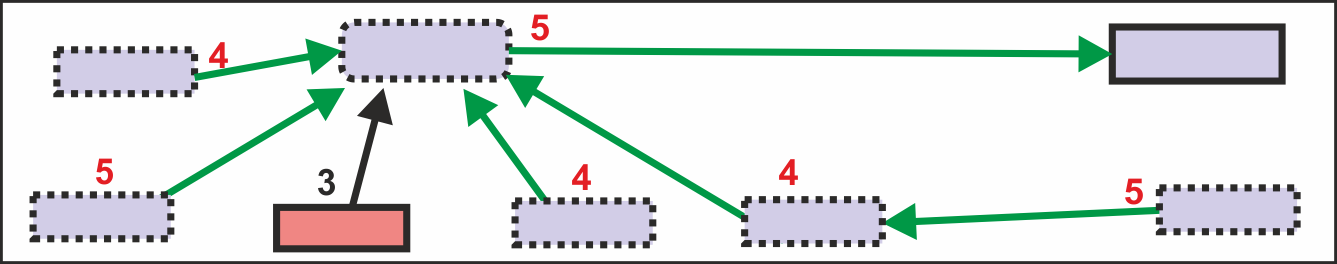
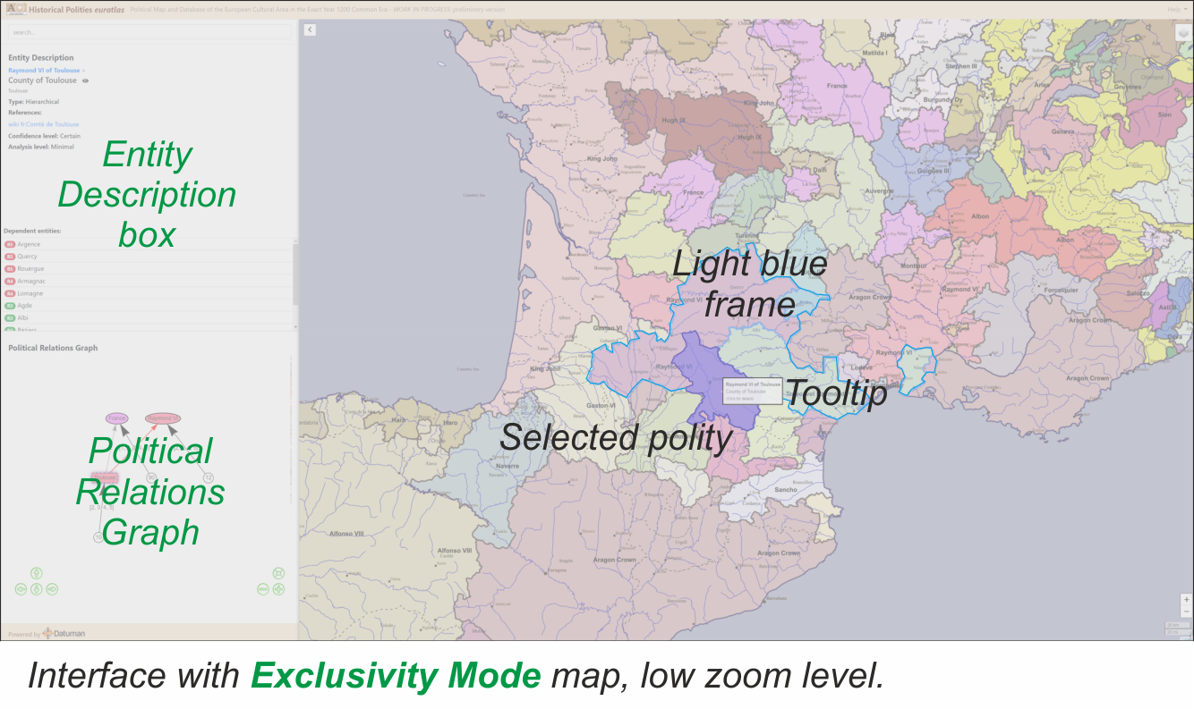
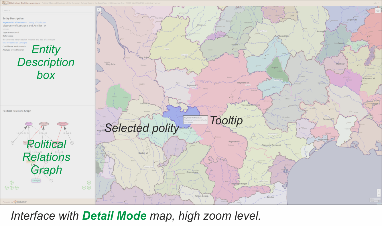
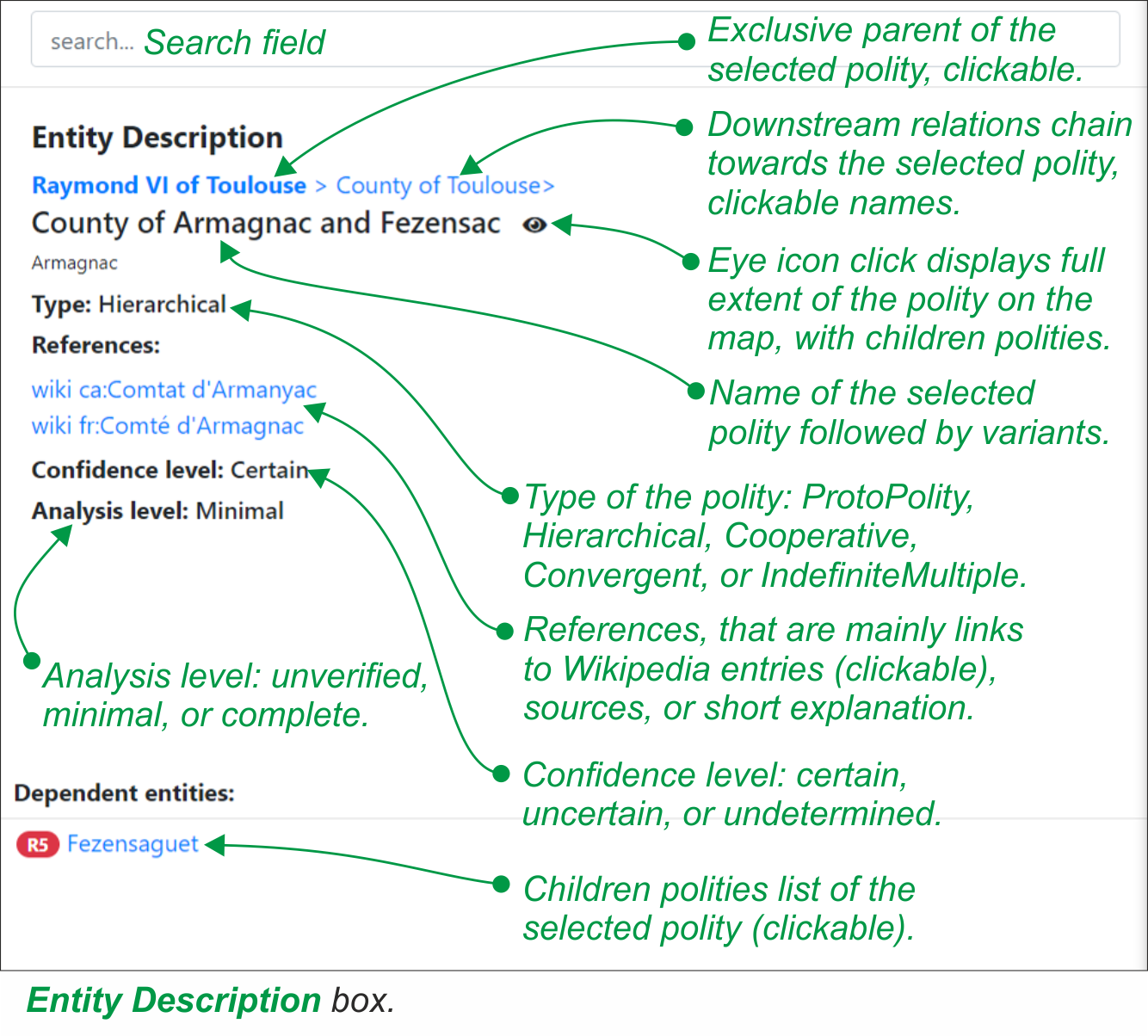
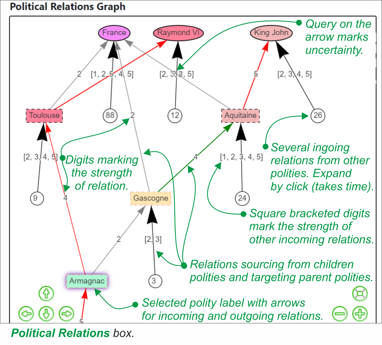
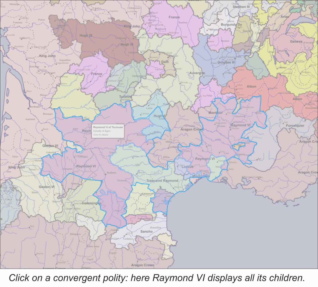
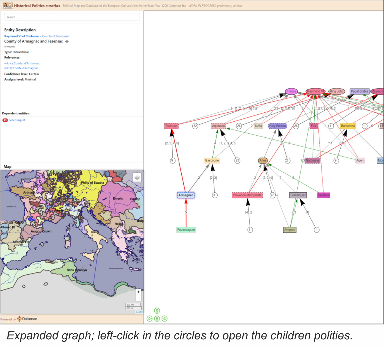
All known polities are drawn on a zoomable , scrollable map . While browsing, a tooltip shows the parent’s name and the name of the polity flown over by the mouse. Left-click on a polity, and it shows its data in the Entity Description box with, if applicable, incoming and outgoing relations in the Political Relations Graph . Right-click and it deselects the polity. By low zoom, or Exclusivity Mode , all polities are shown with the color of their parent exclusive polity. By high zoom or Detail Mode , each polity gets its own color, framed by the color of its exclusive parent polity. If a parent exclusive polity is selected, all children lands come into display on the map with a light blue frame.
MORE FEATURES
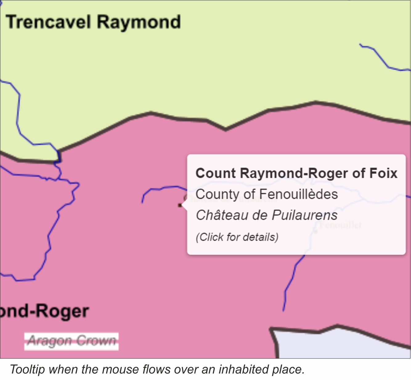
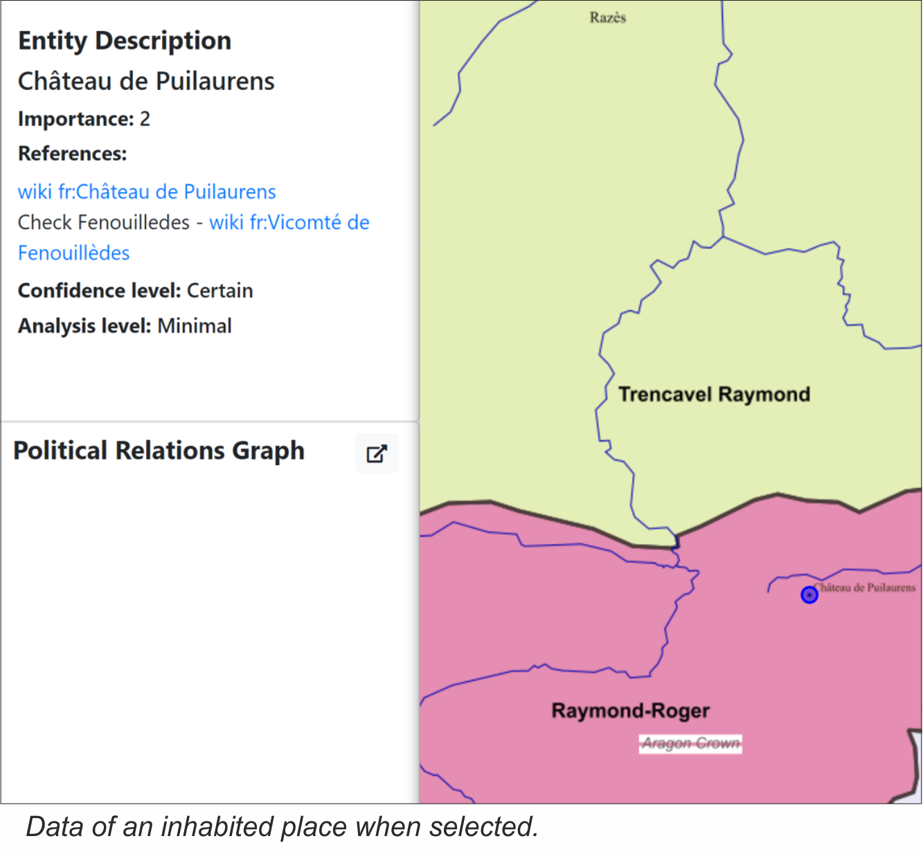
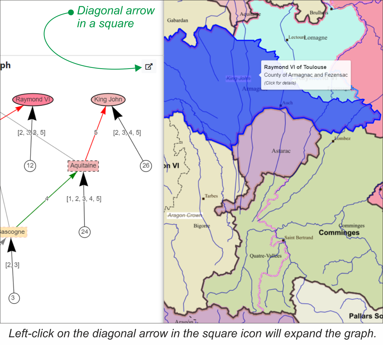
When flowing exactly over an inhabited place, village, castle, or town, the tooltip is displayed below the polity’s name, and the name of the place with the mention (Click for details) . A left-click on that place will show its data, if available, in the Entity Description box. Moreover, it is possible to expand the Political Relations Graph by left-clicking on the diagonal-arrow icon of the Political Relations Graph box. This will open a new tab, and switch between map and graph on the main screen, enabling a large expansion and clearer view of the graph.
ABOUT US
Historical Polities 1200 Common Era preliminary version is a work in progress being processed by Euratlas. See here
POWERED BY A DATUMAN SOFTWARE
Euratlas Historical Polities was made thanks to an useful online Scala software implemented by Datuman S.à r.l to manage complex historical knowledge. This software has a great flexibiltiy in the modeling of informations and it offers intuitive user interface to manage and view the data. In particular, this program allows the display of an open-access map like OpenStreetMap (OSM) over which several layers may be added for the creation of objects like territories, shores, water courses, inhabited places and so on. Thereafter, the data pertaining to each object, name, variants, references, and more, can be added on a georeferenced map. The subsequent database may be viewed under the form of a list, map, or several graphs. If you need a similar tool, Datuman can outline an quote for the use of such a softwarethat is tailored to your needs: info@datuman.ch
CONTACT US
You have comments or questions about Euratlas Historical Polities, you can contact us at the following addresses.
For technical aspects concerning features of the software: info@datuman.ch
For historical aspects concerning the depicted data: euratlas@gmail.com